Access
For trail areas, as well as for a trail in particular, consult the
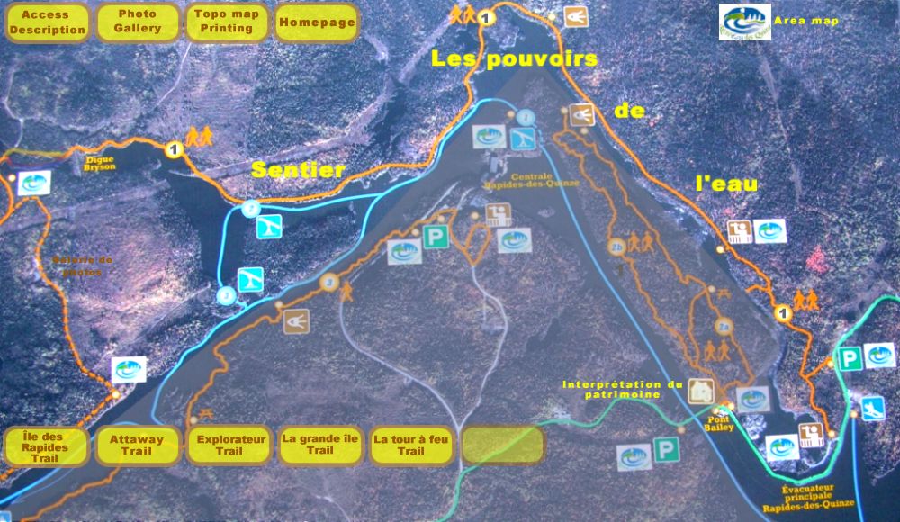
Site Area Map
and the accompanying text for road assistance.
Access to "Pouvoir de l’eau" trail
Two possibilities:
- If you choose to take the Chemin du Pouvoir
(south entrance), and stay on your right, you will reach the Bailey bridge
and parking area for the Explorateur
trail. By foot, you then cross the Bailey bridge and the long dam (1 km)
which is the main Rapides-des-Quinze sluice-gate. Roughly 1 km farther
along, near the lookout, you arrive at the “Les pouvoirs de l’eau”
trailhead.
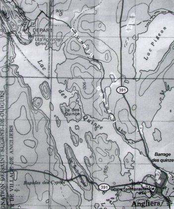
See map above - This trail can also be reached from the south via route 391. After crossing Angliers, head north to Guérin and the “Barrage des Quinze” (dam), 50 m branch off left, take Chemin Geovani and drive 5 km to the parking area and pouvoirs de l’eau trailhead. See the opposite map.
Description
Trail # 1 linear, 6 km (one way), considered as a moderate-difficult trail.
This trail becomes progressively more and more difficult as you progress. The
first kilometre is more like a warm-up for hikers while the next two
kilometres are more challenging. According to Joseph Jacob, “here, teenagers
can really turn it on.”
One easily forgets his fatigue due to the breathtaking views through the
magnificent red and white pine forest while continually aware of the
presence of water.
The pouvoirs de l’eau trail leads
us directly to La grande île trail.
Some hikers will backtrack after 1 km after admiring the kettle basin, others
will backtrack at the end of the trail and others, will continue their
adventure to the Grande île trail.
(Some others will have left a shuttle car at the other end)
A bit of interesting information:
Documented historical fact teaches us that this trail has undergone many
name changes. At the beginning, Récré-eau des Quinze residents described
this trail in geographical terms: they first called it “Sentier nord” (The
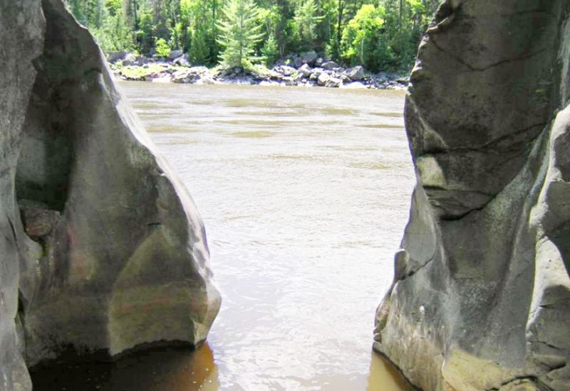
northern trail). Then, after discovering how water and stone had transformed
the landscape and shaped the 10 meter high Kettle basin, it took the name
“sentier des marmites” (Kettle basin trail). In 1920, Northern Quebec Power
decided to harness these waters by building the Hydro Electric Dam. It is
only then that a consensus for the name was reached: “Les
pouvoirs de l’eau” (the power of water). The name speaks for
itself.
Today, we are urgently invited to engage in a pact with water, a gift of mother
nature. Nothing less than a total commitment from all of us will preserve
such a gift and a heritage left for our use and for
future generations.
Top of page